
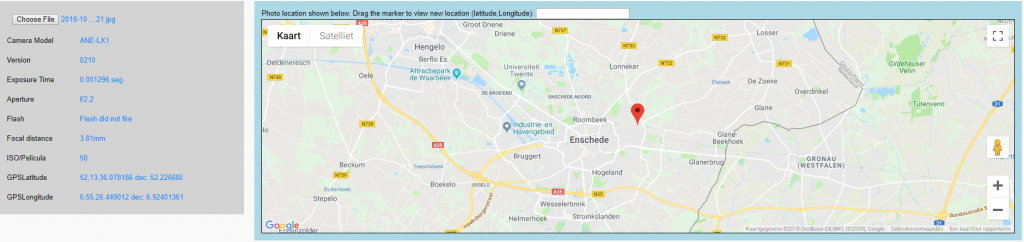
Today I created a coding example which demonstrates how to read Exif data from an uploaded photo and extract the GPS location from that and show the location of where the photo was taken using Google Maps.
To accomplish this, I combined two pens from CodePen into this example:
Some code was added to get the Exif data and display that, and to convert the Exif-version of the location data to data which can be used in Google Maps.
This is a nice example of how to combine code snippets (eg. from CodePen) into new challenging demo’s. This is how it looks:
Click the image to go to the example in CodePen, or go here: https://codepen.io/vanslooten/pen/EOmoEz
Thanks to Abhishek and Romswell Roswell Parian Paucar.